
Read this article in Spanish.
Feature image: Aerial view of Lake Mendota and Lake Menona, from north-west.
– – –

Wikimedia Commons [1a].
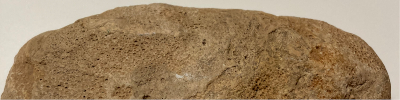
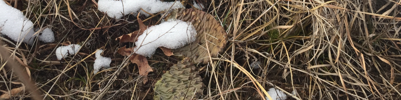
4.5″ in length.
Found in Oconomowoc, Wisconsin.
A shallow ocean rose with the formation of the North American continent. Later, glaciers carved the top of its ocean floor under its immense weight. At the edge of a ice sheet extending northward more than 19,000 square miles, a geological marvel occurred.
Underneath, a small river system carving its way slowly over the desiccated hardened sandy-bottom of an ancient ocean. In time, the waning and waxing of this ice ridge will carve this river into a massive system of lakes. It deposited the crushed remains of rocks and dust. The dust blew in the wind and developed into a rich brown icing that would conceal the bone-dry sandy rock beneath.
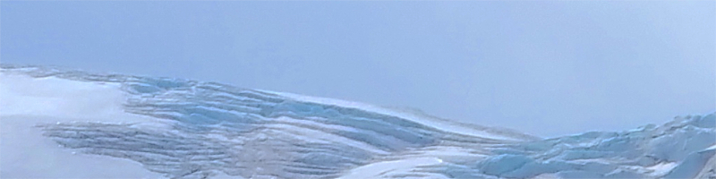
Baffin Island, Nunavut, Canada, Aug 2018,
Gregory “Slobirdr” Smith, Wikimedia Commons [2a].
Baffin Island, Nunavut, Canada, Aug 2018
Wikimedia Commons [2a].

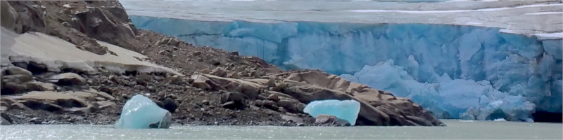
Taku Glacier, near Juneau, Alaska, Sept 12, 1992
LCGS Russ, Wikimedia Commons [3a].
Let’s imagine what it must’ve been like. Native Americans traveling across the plains of North America would have to first cross the Mississippi River [3] travel upstream the various tributaries to find a spring-fed oasis, amongst a collection of stagnant lakes and miles mucky marshes. People groups capable of water transportation could navigate this journey easier, whereas those who had adapted to the prairies would arrive slowly.
Dry prairies to the north, the soils having been scoured and washed by ice melt [4], could establish a local prairie-dwelling community. The much larger more fertile plains to the west of the Mississippi would support larger populations. These imposing people groups would need to be granted entrance into these lands. Coniferous forests in the far north acted as a natural barrier against the marauding, trading, and navigating peoples of Lake Superior. The deciduous forests to the south of these lakes, being more abundant in nuts and fruit, supported burgeoning civilizations. The rivers to the east feed into the Lake Michigan and provide enough resources for communities to settle permanently.

11-14th Century.
Found in Missouri, USA,
Wikimedia Commons [6a].

USGS, Wikimedia Commons [8a].
Wikimedia Commons. Walmart [33a].

USGS (data), Wikimedia Commons [9a].

Wikimedia Commons [34a].

USGS, Wikimedia Commons [7a].

Wikimedia Commons [35a].
Over a series of hundreds of years, travelers from all over became settlers and created artificial mounds mirroring the geometry of the natural topography. The artificial mounds would vary from the oblong rough ridges and drumlins. They were the shapes of creatures, mythical and real. Some of these mounds would act as indicators of the heavenly realms (vistas, vantage points, open sky) and lower realms (wells, caves, springs). The wise must have needed to discern between those that were informative from those that were created ritualistically.

Illinois, USA,
Wikimedia Commons [5a].
The Marching Bear Mound Group,
Iowa, USA,
National Park Service, Wikimedia Commons [4a].
Compared to the bountiful lands to south, these frigid lands would be considered northern. The north meant where the winter cold would stress and kill any inexperienced community, commanding fear and respect. In these unique lands, the intensity of the sun is the same as the Mediterranean, whereas the winter as cold as those in Ukraine or Russia [5][6].
Far-away events in the Caribbean would end the world as they knew it. Word spreads of mysterious creatures appearing out of nowhere, horses and pigs. Before and after the introduction of horses in the Americas, many northern Native American groups relied on dogs [7][8]. After horses fled from Spanish captivity, the Plains Indians performed the fastest technological adaptation and domestication of horses seen by any group of humans in the world [9]. Armies of horse-riders formed in the southwest and make their way rapidly across vast expanses.
In what is now the southern US, large city states are being toppled after they encountered a new foreign people arriving at the shores and charging into the interior in an infernal manner to scout the lands [10][11][12]. In the north east, another foreign people arrive upon the shores. At first the interactions with these foreign settlers is cool, but soon they will be entrapped in a complex network of international rivalries all interested in subduing and extracting resources.
Immigrants, who were in many ways refugees, amass on the shores from the ecologically-failing lands of Europe, and their mob rule would result in extermination. Internal native refugees escaping the destruction of forests near the Atlantic for the construction of cities and other commodities flee inland and nestle into sanctuaries near the Mississippi River, quarreling with the various tribes and the mixed-descent elite who were privileged by the French, who had limited settlements along the Mississippi to control the fur trade.

Taxonomic Data Center (TDC) map,
Biota of North America Project (BONAP), 2014 [10a].
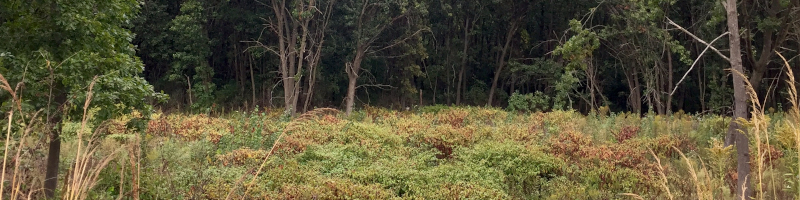
Blue River Sand Barrens, WI, Mar 2018.

North Dakota, Aug 2002,
Wikimedia Commons [11a].
Metropolitan Museum of Art,
Wikimedia Commons [12a].

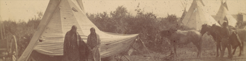
Robert N. Dennis collection,
Wikimedia Commons [13a].
In the southwest, the tribes of horse-riders continued to grow. Certain tribes developed warrior cultures where winning and taking people’s belongings was the principle means to accrue to wealth and prestige over enemies. Horses would be fought over and amassed into collected herds [9]. These lifestyles threatened immigrants wandering further west. Horse theft was nothing new to Europeans [14].
Meanwhile, the opposite was occurring in the northeast. Immigrants from Europe arrived, barrage after barrage. In Europe, land was controlled by a small elite, new immigrants in America replicated the same system of land ownership, however with more land to distribute among the population. Unimaginably large lots would be controlled by single families and then sold bit by bit. The settlers who moved west lived in isolated farms surrounded by adventurers, and quarreling transient hunters. A seemingly endless supply of land and resources created the illusion that such system could not have consequences. The cities of east would soon begin to resemble the cities of Europe but with the added flare of new architectural styles and building materials. Stylizations of architecture, characterizations of people in literature, and publications fetishized the now disappearing way of life.

Great Hall, Thomas Jefferson Building,
Library of Congress.
Wikimedia Commons [16a].

Right: Head and tail of medallion commemorating James Madison featuring a tomahawk axe and peace pipe.
Wikimedia Commons [17a].
On one side, the completely sedentary culture of the east would glamorized itself as uniquely American despite it being deeply influenced by the English and the Dutch. Further away from the coast, more and more prospectors took control of land and its resources. Skirmishes in far-flung outposts and attacks on homesteads began to be sensationalized in the press.
On the other side, the west became a frontier for adventurers, prospectors and foreign powers like the French and the Spanish interested in maintaining a control over the fur-trade and expanding territories. The native American cultures would develop themselves and their inter-tribal relations around horses and new technology, while the hunting/foraging opportunities and ecological networks that supported them collapse.
These two cultures, the sedentary American cities and the warrior nomadic tribes, would clash as the latter collectively strove to annihilate the former.

1882,
Autobiography of Ma-ka-tai-me-she-kia-kiak or Black Hawk,
Wikimedia Commons [18a].

1848,
Wikimedia Commons [27a].
Sensing the end of their world, new alliances form and prophecy ruled. In the collapsing environment, stress gave way to fanaticism. Elders foretold prophecies and young leaders arose. In a social movement unlike any other, a new leader, Blackhawk, and his crew crossed the Mississippi and lead his people to win back their land and their way of life. Thousands followed Blackhawk across the Mississippi.
Simplistic and tantalizing characterizations of people like Blackhawk and the Prophet White Cloud, made it easy for the press and the public to make sense of the anarchic situation. In several instances, young men became reckless and attacked who they saw as their oppressors. These attacks made the headlines. The US military saw a need to secure the safety of homesteaders against raids. After not receiving support from their native allies and the British, Blackhawk, his crew and the women and children would retreat into the hard to navigate marshy four lakes region.
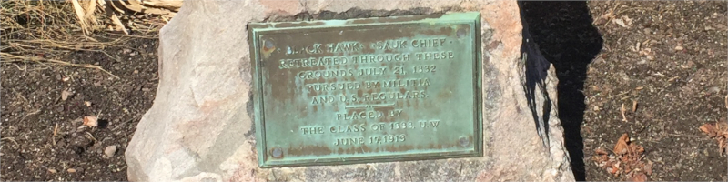
Reads:
•BLACK HAWK• •SAUK CHIEF•
RETREATED THROUGH THESE
GROUNDS July 21, 1832
PURSUED BY MILITIA
AND U.S. REGULARS
— • —
PLACED BY
THE CLASS OF 1888. U.W.
JUNE 17, 1919
UW-Madison Campus, Mar 6, 2022

near Prairie du Chien, Wisconsin, Jul 2012,
Jeff the Quiet, Wikimedia Commons [14a].
The US military establishment was in its infancy, looking to become superior than its European antecedents. It can only be assumed that lack of infrastructure and development gave way to communities of fanatical citizens, which were not under the complete authority of the US military. Mob rule would be coerced by a military, which had been seduced by the old naïve fantastical visions of ordered war and wished to preserve its honor. The areas around today’s Olbrich Park where Blackhawk’s people are said to have traveled were marshy and very hard to navigate [15], which causes speculation about a massacre, since they would later suffer one on the shores of the Mississippi.
This mob-ruled genocidal force is yet to be fully understood or acknowledged by our society, partly because it demonstrates the humble disorganized origins of the fiercest power in the world and accuses the nebulous masses of settlers. Instead, today historians depict this conflict among many others as a sequence independent wars and skirmishes fought primarily between the US military and enemy combatants known as the Indian Wars.
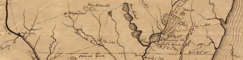
Indian Campaign of 1832, Map of the Country,
Edwin Rose, University of Illinois – Urbana-Champaign,
Wikimedia Commons [19a].
In the end, Blackhawk continued past the four lakes region, fled into the driftless region but was trapped at the Mississippi River, where a massacre has been acknowledged. With the help of the Decorah, a French-Indian family, Blackhawk surrendered and spent the rest of his life in isolation and examination [16]. The Blackhawk War became the pinnacle conflict in a myriad of battles against Native American tribes [9].
The sensation caused by the war, including a supposed autobiography of Blackhawk, seduced a new wave of travelers to arrive to the region. These events have influenced the pattern of human settlement drastically, and therefore are important to understand the ecology of the area.

In view: snapdragons (Antirrhinum majus), and pansies (Viola wittrockiana).
April 27, 2020.
Blackhawk Memorial, UW-Madison Campus.
All of these stories are important to consider since they set the stage for the creation of the topic of this work. Catfish Valley is the name that settlers of the United States of America would give to the large valley and the river that fed into the other lakes, totaling about 4, that’s if you don’t include the nearest adjacent lakes. This land would become a tourist destination where adventurers could navigate the crystal clear lakes inside a chief’s canoe [16].
Prospectors knew immediately the value of such real estate and began lobbying the government to have this land be the location of the territory’s new capital, named after the recently deceased ex-President James Madison.
Fast forward, a flood of farmers into the region and the successive collapse of several industries after environmental degradation necessitated the construction of a land-grant university that would develop the intellectual resources necessary to support the population. Reflecting the similar trend in Europe, this college-town city accrued wealth and social capital that would keep the region preserved as uniquely wealthy and advantaged. The involvement of the military in the arrival of the settlement brought the best engineers that would turn murky backwaters into discrete lines of arable land and lakefront.

1855,
Samuel Hunter Donnel,
Wikimedia Commons [32a].
Questions still remain about the landscape changes. Were there more or less trees before or after or at anytime during the era of mound building? Were prairies the dominant habitat? We know that before the glaciers retreated, this region was frigid and populated by plants very different than those we see today or anytime during the mound building era.
Were there more or less trees after US-American settlement? Are there more trees today due to urban forestry than there were when the land was settled? One thing is for sure, littoral zone habitats have been impacted drastically by development along the lakes’ shores. Pavement or other hard surfaces have replaced the permeable vegetated surfaces affecting drainage, run-off quality and flood frequency. Surveyor notes reveal much about the landscape of the state of Wisconsin as early as 1832 [18].
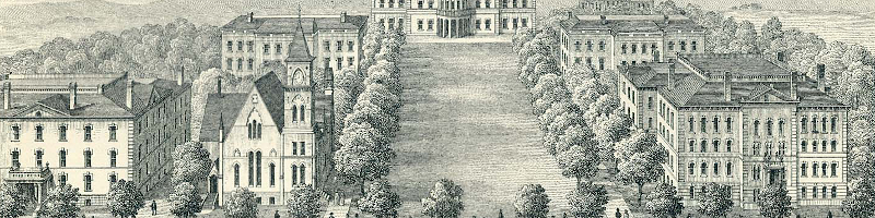
(left: Music Hall, right: Science Hall)
1885,
Milwaukee Litho. & Engraving,
Wikimedia Commons [21a]
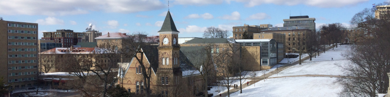
(Off-center: Music Hall)
UW-Madison campus,
Runawaysquash, Mar 25, 2014,
Wikimedia Commons [22a]

1907.
Lake Mendota, and Picnic Point,
UW Archives, UW-Madison [30a]

Jun 28, 2022
‘3D Imagery on Google Earth’ layer,
Google Earth (website) [31a].
1864.
Wikimedia Commons [28a]
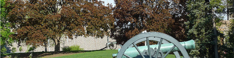
Apr 18, 2012 & Jul 5, 2009.
Wikimedia Commons [29a]
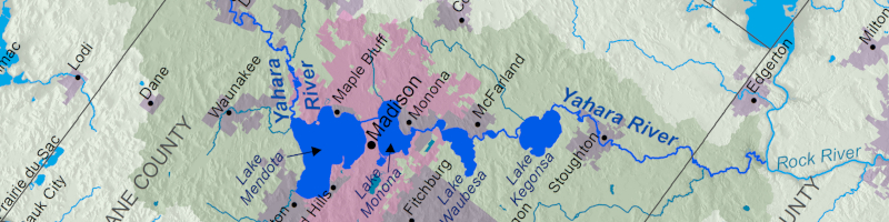
In the aftermath of the anarchic conquest, the new settlers and intelligentsia wished to preserve the Americanness that separated them from their European counterparts by naming neighborhoods, streets, schools and lakes after Native American tribes from the region and far-away. The Four Lakes were named Mendota (Dakota language)[19], Monona (Potawatami)[20][21], Waubesa (Ojibwe )[22][23], and Wingra (Hocąk)[24][25]. The river that connects the four lakes was once called Catfish River. The entire watershed was known as Catfish Valley [16]. Catfish in Hocąk is transliterated into English as ‘Yahara’ [26]. Today, environmental awareness advocates educate the public about the lakes’ Yahara watershed.

Wikimedia Commons [20a]
Wikimedia Commons [20a]
The construction of buildings in the city of Madison necessitated the destruction of most of all of the mounds that surrounded the core of this area. Thankfully due to the concentration of development in the central isthmus, mounds in other areas have been preserved. Areas in the west side of the UW-Madison campus, UW-Arboretum and Mendota Mental Hospital are examples of areas where mounds were preserved.

1885.
James E. Heg,
Wikimedia Commons [23a].

James Steakley, 2007,
Wikimedia Commons [24a]

USGS 3D Elevation Program LIDAR (hillshade), 2017 [27].
Though no ancient stonework is known publicly at the moment, stonewalls were erected by landscapers in the turn of the century. One such construction was popularized by a Danish immigrant Jens Jensen, who after living in Chicago, Illinois, saw the benefit of preserving the spirit and character of the land through native plantings and semi-circular benches made of locally-sourced stone called council rings. In many areas, these council rings have been falsely replicated by the construction of stone amphitheaters that have a similar appearance, but a different source and function. This architectural trend inspired immigrants and long-time residents to study the flora of the region and forge a relationship to the land.

~1933
The Clearing, Highland Park,
Lake County, Illinois.
Wikimedia Commons [25a].
Madison, WI.

Picnic Point, Lakeshore Nature Preserve,
Madison, WI [28] [29].
In the aftermath of the demographic and infrastructural changes, surveys of the local flora were made. As settlers moved in, horticultural practices created a landscaped mixed with plants native to the region and introduced from Europe. Exotic shade plants from Europe and then Asia were placed near the foundations of homes, and beneath the growth of old native oaks species. The homes near the center of the city and the centennial trees surrounding them obscure the natural contours of the land. The prairie habitats, which contained a multitude of seemingly useless plants foreign to the new people groups, were almost decimated by the establishment of farms.
Curtis Prairie,
UW-Arboretum, Apr 2019.
Grady Tract,
UW-Arboretum, Sep 2017.
It took botanists and scholars from the university to survey the few regions that had not been cultivated to determine the proper composition of plants that had existed prior to settlement and cultivation. Failing farms under the control of the federal government’s Civil Conservation Corps (CCC), a civilian outfit ran by trainee military officers under the authority of General Douglas MacArthur [30], were bought by the university together with adjacent farms and a sinking neighborhood [31]. Several botanists and other natural scientists had been already been assigned to the CCC’s work project.

Wingra Woods,
UW-Arboretum,
USGS 3D Elevation Program LIDAR Data (hillshade)[27], 2017.
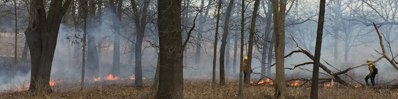
On this land, the university established the UW-Arboretum. Unique among arboreta, it primary mission was to research restorative ecology and is mostly composed of research areas that simulate different plant communities native to the region, like woodlands and prairies. Disney filmed a scene of a prairie fire used in a movie, since Curtis Prairie was the largest tract of intact prairie in the region and the first of its kind in the United States [32].

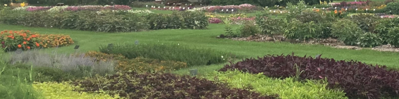
Longenecker Horticultural Gardens,
UW-Arboretum, May 2019.
Similar to other traditional arboreta, it has an exotic collection of trees and shrubs that are also used for ecological research and pleasure. Research in the UW-Arboretum Longenecker Horticultural Gardens (LHG) ranges from monitoring how native insects interact with introduced ornamentals [34], developing pollinator friendly turfgrass practices, and surveying genetic diversity. The LHG is also a classroom where professors from the university teach landscape plants courses . Data from the collection is shared with premier institutions around the world. The exotic collection is just like a living museum with its own curator. The spring blooms attracts many visitors. A visitor center educates the public about phenology, ecology, and other important wildlife conservation topics.
Longenecker Horticultural Gardens.
UW-Arboretum,
Madison, WI.
The campus of the university has also been conserved. Pedestrians will find Native American mounds are along the lakeshore path dedicated to biologists dedicated to cancer researcher. Large tracts of land west of the campus, such as Lakeshore Nature Preserve protect the shores of Lake Mendota with managed forests teeming with wildlife, hiking trails, and a community garden running since the 1960’s on the slope facing away from the lake.
Eagle Heights Community Gardens,
UW-Madison, May 2021.

Lake Shore Preserve in background,
UW-Madison, Aug 2021.

UW-Madison,
USGS 3D Elevation LIDAR Data (hillshade), 2017 [27].
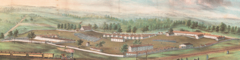
At the edge of the city, the West Madison Agricultural Research Station (WMARS) has rows of hardy grapes to help the growing viticultural industry in Wisconsin, organically grown raspberries and strawberry rows where they study the effects of harvesting on yields, and ornamental garden where plant hardiness is determined in the cool rural nights and a myriad of other activities.

On the east side of the City of Madison, across the isthmus, local leaders and neighborhood garden clubs worked together to purchase lakefront property to protect it from over-development. They turn it into pristine open parks with amenities such as sport recreation areas, wildlife habitats, German-style beer garden and a world-renown botanical garden. They named the park Olbrich Park, and the botanical gardens, Olbrich Gardens, after one of the local leaders’ last name.

early Spring,
Olbrich Botanical Gardens,
Madison, WI.
mid-Summer,
Olbrich Botanical Gardens,
Madison, WI.

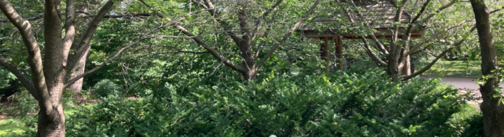
Thai Sala,
Madison, WI, late May 2021.

Thai Sala,
Madison, WI, late July 2021
Olbrich Garden’s veneer may appear modern, thus incorporating exotic plants as their main attraction, yet the herb garden features a Native American kitchen garden with hocąk signage and several gardens are planted with ornamental plants sourced from native plant populations from the region, known colloquially as nativars, since they might be different from wild uncultivated populations of native plants. The botanical gardens feature state-of-the-art greenhouses where annual plants are grown from seed, and a conservatory, where visitors can experience the rainforest in the middle of winter.
Odana Forest,
Madison, WI.
Of the trees that are thought to have existed prior to extensive settlement, those that have been planted are Northern Pin Oak (Quercus ellipsoidalis)[35], White Oak (Quercus alba), and Black Oak (Quercus velutina). Prairie plants such as Bee Balm (Monarda spp.) , Cupplant (Silphium perfoliatum), and a variety of dazzling asters are now planted in strips on the side of the bike-paths that once used to be the railroads feeding the city.
In the last century, changes have occurred that have promoted the education of inhabitants to understand the way water flows down each watershed, learn how to identify native plants, and learn about the history and importance of the land. Meanwhile, more foreigners, most from other states in the US, but also internationally (like the author), continue to migrate to the region bringing with them new insights, but also continuing the process of urban development that obscures the land’s character and contributes to the demise of its health.

Winter,
Madison, WI
Unlike cities like Mexico City, evidence of an infra-structurally developed pre-Colombian society has not been discovered in Madison. The nearest pyramidal mound city was found between Madison and Milwaukee. In 1837, archeologist named the area Aztlan State Park in honor of the mythologized northern homeland of the Mexica or Aztecs [36]. There is no known evidence that this is the homeland of the Mexica. However, it was connected to Mississippian cities that were connected to the Mesoamerican trade network [12]. The lack of archeological preservation in the Madison area has resulted in a changed landscape difficult to study, because its clues are nuanced and the vision of the landscape is obscured by our way of life.
Understanding the progression and changes in the landscape requires us to study the lives of people before us, and to imagine a world that operated on a completely different network of resources. In our society, we have depended on goods transported predominantly by trucks, but also by railways and airplanes, whereas the smaller populations before would have thrived on the composition of plants and animals on the ground and in the water, and used techniques to preserve these resources for later consumption.

Devil’s Lake, or Spirit Lake,
east towards Portage, Wisconsin, June 6, 2021.
The descendants of the original inhabitants of this region still remain. Their customs are a source of knowledge and continue to provide insights about this environment and how to preserve it. Many of them became refugees during the land’s settlement and have dispersed populations. The hocąk live across several regions: Wisconsin, Minnesota, but also Nebraska [37]. The Kickapoo live in Wisconsin, Texas, and near the northern border of the country of México.
Botany and horticulture are a fields of study that could help researchers uncover lost uses of local flora and teach people how to become stewards of the land. While respecting the customs and traditions of all peoples, we also strive to uncover the mysteries using all the tools at our disposal and for the benefit of humanity.

National Map, USGS [26a]
Added white line ≈ 20.4 km ≈ 12.68 mi
Author: Gustavo Meneses
Published: 2023-07-26
Revised: 2024-04-01
Read more
Bushnell, David I. Jr. 1992. “Villages of the Algonquian, Siouan, and Caddoan tribes west of the Mississippi.” Smithsonian Institution. Bureau of American Ethnology. Bulletin 77. pg. 120 https://archive.org/details/bulletin771922smit/page/n173/mode/1up?view=theater
UW-Arboretum. University of Wisconsin – Madison. https://arboretum.wisc.edu
Owen Conservation Park. City of Madison. Parks Divison. https://www.cityofmadison.com/parks/find-a-park/park.cfm?id=1305
West Madison Agricultural Research Station. University of Wisconsin – Madison. https://westmadison.ars.wisc.edu
References
[1] “Devonian.” Energy Education. University of Calgary. Website. Accessed Jan 19, 2023. https://energyeducation.ca/encyclopedia/Devonian
[2] “Corals.” University of Wisconsin – Madison. Division of Extension. Wisconsin Geological and Natural History Survey. Accessed Jan 19, 2023. https://wgnhs.wisc.edu/wisconsin-geology/fossils-of-wisconsin/coral-gallery/corals/
[3] “gichi-ziibi”, The Ojibwe People’s Dictionary. Website. Accessed Jun 21, 2023. https://ojibwe.lib.umn.edu/main-entry/gichi-ziibi-ni
[4] “Central Sand Plains”. Wisconsin Department of Natural Resources (WDNR). Website. Accessed Jul 26, 2023. https://dnr.wisconsin.gov/topic/lands/EcologicalLandscapes/CentralSandPlains
[5] “Latitude Comparison of North America and Europe/North Africa.” Earthly Mission. Website. Accessed Jan 30, 2023. https://earthlymission.com/latitude-comparison-of-north-america-and-europe-north-africa/
[6] Dixon, M. Strenth, N. Chodacki, G. LeBrasseur, K. Maddox, T. “Annual Mean Temperatures”, part of “9 – Climate & Biomes” Biology 1409 – Man and the Environment Lab. Angelo State University. Image. Accessed Jan 30, 2023. https://www.angelo.edu/faculty/mdixon/ManEnvironment/globaltemps.jpg
[7] Kelly, Fanny. 1871. “Narrative of my captivity among the Sioux Indians.” Cincinnati, Wilstach, Baldwin & Co. University of Pittsburgh Library System. Archive.org. pg. 92. Accessed Jan 21, 2023. https://archive.org/details/narrativeofmycap00kell/page/92/mode/2up?q=dogs
[8] Leonard, JA. Wayne, RK. Wheeler, J. Valadez, R. Guillén, S. Vilà, C. 2002. “Ancient DNA Evidence for Old World Origin of New World Dogs.” Science, Vol 298, Nov 22, 2002. https://www.consevol.org/pdf/Leonard_2002_Science.pdf
[9] The Great Indian Wars 1540-1890. 1991. TV Series. https://www.imdb.com/title/tt5950468/?ref_=fn_al_tt_1
[10] Tutor, Phillip. “The hunt for Mabila.” The University of West Alabama. News. Website. Accessed Jan 21, 2023. https://www.uwa.edu/news/hss/huntformabila
[11] Santa Fe National Historic Trail: Coronado Quivira Museum. National Park Service. Website. Accessed Jan 21, 2023. https://home.nps.gov/places/coronado-quivira-museum.htm
[12] Barnhart, Edwin. “Episode 14: De Soto versus the Mississippians.” & “Ancient Civilizations of North America.” The Great Courses. Amazon Prime. https://www.amazon.com/gp/video/detail/B07M62BXTM/ref=atv_dp_share_cu_r
[13] Dieterle, Richard L. “Origin of the name “Winnebago” (Menominee)”. The Encyclopedia of Hocąk (Winnebago) Mythology. Website. Accessed Jan 19, 2023. https://hotcakencyclopedia.com/me.WinnebagoNameOrigin.html
[14] “Warum sagt man: “Mit jemandem Pferde stehlen können”? Warum!-Redaktion. Jul 5, 2019. Website. Accessed Jan 26, 2022. https://www.warum-magazin.de/ressort/redewendungen/warum-sagt-man-mit-jemandem-pferde-stehlen-koennen
[15] onfire4jesus. “Third Lake Passage Historical Marker”. Waymarking. Website. Accessed Jul 26, 2023. https://www.waymarking.com/waymarks/WM2060
[16] “Madison, Dane County and surrounding towns : being a history and guide to places of scenic beauty and historical note … early intercourse of the settlers with the indians … with a complete list of county supervisors and officers, and legislative members”. 1877. Wm. J. Park & Co. University of Michigan. Archive.org. Accessed Jan 25, 2023. https://archive.org/details/madisondanecoun00cogoog/mode/2up
[17] “Lakeside Water Cure”. Historic Madison, Inc. Website. Accessed Jul 26, 2023. https://www.historicmadison.org/lakesidewatercure
[18] “Wisconsin Public Land Survey Records : Original Field Notes and Plat Maps”. UW Libraries Search. University of Wisconsin-Madison. Website. Accessed Jul 25, 2023. https://digital.library.wisc.edu/1711.dl/SurveyNotes
[19] “Bdote.” Dakota Dictionary Online. Department of American Indian Studies. University of Minnesota. Website. Accessed Jan 21, 2023. https://fmp.cla.umn.edu/dakota/browserecord.php?-action=browse&-recid=1099
[20] “mnomen.” Potawatomi Dictionary. Cultural Heritage Center. Website. Accessed Jan 21, 2023. http://potawatomidictionary.com/Dictionary/Word/3896
[21] “Historical Essay: Monona.” Origin of Monona, Wisconsin. Wisconsin Historical Society. Website. Accessed Jan 21, 2023. https://www.wisconsinhistory.org/Records/Article/CS10747
[22] “Historical Essay: Lake Waubesa [origin of place name]” Dictionary of Wisconsin History. Wisconsin Historical Society. Website. Accessed Jan 21, 2023. https://www.wisconsinhistory.org/Records/Article/CS9626
[23] “waabizii.” Ojibwe People’s Dictionary. Website. Accessed Jan 21, 2023. https://ojibwe.lib.umn.edu/main-entry/waabizii-na
[24] See “hwįjara” and “wįǧra”. Hocąk Lexicon. Website. https://hotcakencyclopedia.com/ho.HocakLexicon.html
[25] “Historical Essay: Wingra Lake [origin of place]” Dictionary of Wisconsin History. Wisconsin Historical Society. https://www.wisconsinhistory.org/Records/Article/CS14476
[26] Wolf, K. Eberhardt, B. 2019. “The word ‘Yahara’ means ‘Catfish'”. City of Madison. News. Website. Jun 21, 2019. Accessed Jan 25, 2023. https://www.cityofmadison.com/news/the-word-yahara-means-catfish
[27] “ELEVATION/LIDAR DATA”. University of Wisconsin – Madison. State Cartographer’s Office. May 5, 2022. Website. Accessed Jan 30, 2023. https://www.sco.wisc.edu/data/elevationlidar/
[28] “Summer 2012.” Lakeshore Nature Preserve E-Newsletter. PDF. Accessed Jan 25, 2023. https://d138k1rt4vd1y.cloudfront.net/wp-content/uploads/sites/27/2017/01/enews2012summer.pdf
[29] “The new picnic point view enhancement and council ring.” /u/s_spectabilis. /r/UWMadison. Reddit. ~2012. Accessed Jan 25, 2023. https://www.reddit.com/r/UWMadison/comments/ocqfv/the_new_picnic_point_view_enhancement_and_council/
[30] Speakman, Joseph M. “Into the Woods: The First Year of the Civilian Conservation Corps.” vol. 38, no.3, Fall 2006, Prologue Magazine. National Archives. Website. Accessed Jun 21, 2023. https://www.archives.gov/publications/prologue/2006/fall/ccc.html
[31] Ferlic, Nolan. “Madison’s ‘Lost City’: Inside the forgotten remains of Lake Forest”, Badger Herald. Sep 14, 2015. Website. Accessed Jun 21, 2023. https://badgerherald.com/artsetc/2015/09/14/madisons-lost-city-inside-the-forgotten-remains-of-lake-forest/
[32] Straka, Thomas. “The Arb wins an Oscar”. ISTHMUS. Website. Accessed Jun 21, 2023. https://isthmus.com/screens/vanishing-prairie-uw-arboretum-oscar/
[33] “English Names for Korean Native Plants”. 한반도 자생식물 영어이름 목록집. 2015. Korean Forest Service. Korea National Arboretum. Archive.org. pg.148. Website. Accessed Oct 13, 2023. https://web.archive.org/web/20170525105020/http://www.forest.go.kr/kna/special/download/English_Names_for_Korean_Native_Plants.pdf
- ISBN 978-89-97450-98-5-93480.
[34] Fuller, Zane. Stevens, David. “Horticulture Garden Notes: Fall 2021”. Arboretum news, UW-Arboretum. Website. Accessed Jun 21, 2023. https://arboretum.wisc.edu/news/arboretum-news/horticultural-garden-notes-fall-2021/
[35] Hipp, AL. Weber, JA. Taxonomy of Hill’s Oak (Quercus elliposoidalis E.J. Hill) in the Chicago Region: Preliminary Molecular Evidence.” International Oak Journal, no 18, Spring 2007. http://www.internationaloaksociety.org/sites/default/files//files/IO/IOS%20Journal%20%2318/International%20Oaks%20No.%2018%20-%20Taxonomy%20of%20Hill%27s%20Oak%20in%20the%20Chicago%20Region%20-%20Andrew%20L.%20Hipp%20%26%20Jaime%20A.%20Weber.pdf
[36] “Archeology.” Friends of Aztalan State Park. Website. Access Jan 25, 2023. http://www.aztalanfriends.org/archeology
[37] Davis, Natalie. 2010. “Ho-Chunk Plants: Indigenous Plants of Winnebago Reservation, Nebraska.” Little Priest Tribal College. Winnebago, NE. PDF. Accessed Jan 25, 2023. https://littlepriest.edu/wp-content/uploads/HoChunk-Plant-Catalog-FINAL.pdf
Images
Featured image: LeMay, Warren. “File:Madison, Wisconsin from Airplane, Madison, WI (52827084249).jpg”. Apr 6, 2023. Wikimedia Commons. Accessed Mar 14, 2024. https://commons.wikimedia.org/wiki/File:Madison,Wisconsin_from_Airplane,_Madison,_WI(52827084249).jpg
[1a] File:Shallow water.jpg, Unknown, Wikimedia Commons. Accessed Jan 19, 2023. https://commons.wikimedia.org/wiki/File:Shallow_water.jpg
[2a] File:Grinnell Glacier, Baffin Island, NU (44407583022).jpg, Gregory “Slobirdr” Smith, Wikimedia Commons. Aug 2, 2018. Accessed Jan 19, 2023. https://commons.wikimedia.org/wiki/File:Grinnell_Glacier,Baffin_Island,_NU(44407583022).jpg
[3a] File:Taku Glacier 1992.jpg, LCGS Russ, Wikimedia Commons. Sept 12, 1992. Accessed Jan 19, 2023. https://commons.wikimedia.org/wiki/File:Taku_Glacier_1992.jpg
[4a] File:Effigy mounds lidar.jpg, U.S. National Park Service, U.S. Geological Survey, Wikimedia Commons. Dec 15, 2014. Accessed Jan 19, 2023. https://commons.wikimedia.org/wiki/File:Effigy_mounds_lidar.jpg
[5a] File:Cahokia-Monks-Mound.jpg
Steven Greenwell
17 September 2018
https://commons.wikimedia.org/wiki/File:Cahokia-Monks-Mound.jpg
[6a] File:Bowl, Bird Head on Rim MET 79.8.27.jpeg
Gift of Henry G. Marquand, 1879
11th–14th century
United States, Missouri https://commons.wikimedia.org/wiki/File:Bowl,Bird_Head_on_Rim_MET_79.8.27.jpeg
[7a] File:Carya illinoensis range map.svg
Halava
Own work (Grass GIS, Inkscape)
14 August 2011
https://commons.wikimedia.org/wiki/File:Carya_illinoensis_range_map.svg
[8a] File:Juglans nigra range map 0.png
Elbert Little
USGS Geosciences and Environmental Change Science Center 1971 https://commons.wikimedia.org/wiki/File:Juglans_nigra_range_map_0.png
[9a] File:Asimina triloba USGS range map.png
Elbert L. Little
USGS Geosciences and Environmental Change Science Center 1978 https://commons.wikimedia.org/wiki/File:Asimina_triloba_USGS_range_map.png
[10a]”County Distribution map of Opuntia macrorhiza – Twisty-Spine Prickly Pear”, BONAP TDC. Website. Accessed Feb 14, 2023. http://bonap.net/TDC/Image/Map?taxonType=Species&taxonId=6718&locationType=County&mapType=Normal
[11a] File:Nokota Horse Stud Band.jpg, Seth Zeigler, Wikimedia Commons. Aug 1, 2022. https://commons.wikimedia.org/wiki/File:Nokota_Horse_Stud_Band.jpg
[12a] File:-Native American Women and Horses by Teepee in Camp- MET DP115232.jpg, Metropolitan Museum of Art, Wikimedia Commons. 1880-90s. Accessed Jan 19, 2023. https://commons.wikimedia.org/wiki/File:-Native_American_Women_and_Horses_by_Teepee_in_Camp-_MET_DP115232.jpg
[13a] File:Winnebagos at Ft. Snelling, 1863, from Robert N. Dennis collection of stereoscopic views.png, Robert N. Dennis collection stereoscopic views, Wikimedia Commons. 1863. Accessed Jan 19, 2023. https://commons.wikimedia.org/wiki/File:Winnebagos_at_Ft._Snelling,_1863,_from_Robert_N._Dennis_collection_of_stereoscopic_views.png
[14a] File:Fort Crawford footings.jpg
26 July 2012
Jeff the quiet built by the U.S. Army at
Prairie du Chien, Wisconsin in 1816 https://commons.wikimedia.org/wiki/File:Fort_Crawford_footings.jpg
[15a] Eben and Roseline Peck Cabin Rare Book, A History of Madison, the Capital of Wisconsin; including the Four Lake Country, by Durrie, Daniel S. (Daniel Steele), 1819-1892, 1819-1892. Published by William J. Park & Company, 1877. Wisconsin Historical Society. https://www.wisconsinhistory.org/Records/Image/IM39269
[16a] File:Great Hall. Detail of cherubs representing America an Africa with putti (fisherman and farmer) on Grand staircase by Philip Martiny. Library of Congress Thomas Jefferson Building, Washington, D.C. LCCN2011636548.tif
1980-2006
Library of Congress
https://commons.wikimedia.org/wiki/File:Great_Hall.Detail_of_cherubs_representing_America_an_Africa_with_putti(fisherman_and_farmer)_on_Grand_staircase_by_Philip_Martiny._Library_of_Congress_Thomas_Jefferson_Building,_Washington,_D.C._LCCN2011636548.tif
[17a] Custom banner – Coinsoverhemp.jpg
File:Hemp-600×600.jpg
Halyma [13a] File:Fort de Chartres, Fort de Chartres State Park, Prairie du Rocher, Randolph County, IL HABS ILL,79-PRARO.V,1-2.tif
Documentation compiled after 1933
Historic American Buildings Survey (HABS) https://commons.wikimedia.org/wiki/File:Fort_de_Chartres,_Fort_de_Chartres_State_Park,_Prairie_du_Rocher,_Randolph_County,_IL_HABS_ILL,79-PRARO.V,1-2.tif
30 September 2009
https://commons.wikimedia.org/wiki/File:Hemp-600×600.jpg
[…] James Madison Bronze Medallion
Johann Mathias Reich
1801
https://www.metmuseum.org/art/collection/search/5114
[…] File:Indian Head Buffalo Obverse.png
Bobby131313
Nov 21 2010
https://commons.wikimedia.org/wiki/File:Indian_Head_Buffalo_Obverse.png
[…] File:Indian Head Buffalo Reverse.png
Bobby131313
Nov 21 2010
https://commons.wikimedia.org/wiki/File:Indian_Head_Buffalo_Reverse.png
[18a] File:Chief Black Hawk2.jpg
Black Hawk. Autobiography of Ma-ka-tai-me-she-kia-kiak, or Black Hawk. Oquawka, IL: J.B. Patterson, 1882.
Charles Bird King
https://commons.wikimedia.org/wiki/File:Chief_Black_Hawk2.jpg
[19a] File:Black Hawk War – DPLA – 40baad8ab16787d6b8899158ce1c2fd5.jpg
Rose, Edwin 1832
https://commons.wikimedia.org/wiki/File:Black_Hawk_War–DPLA–40baad8ab16787d6b8899158ce1c2fd5.jpg
[20a]File:Yahara River WI map.png
Time Kiser,
February 14, 2014
Data from USGS National Map
https://commons.wikimedia.org/wiki/File:Yahara_River_WI_map.png
[21a] File:Bascom Hill University of Wisconsin.jpg
Runawaysquash
25 March 2014 https://commons.wikimedia.org/wiki/File:Bascom_Hill_University_of_Wisconsin.jpg
[22a] File:UW looking up Bascom Hill, 1885.jpg
Milwaukee Litho. & Engraving
1885
https://commons.wikimedia.org/wiki/File:UW_looking_up_Bascom_Hill,_1885.jpg
[23a] File:Mendota Mental Hospital.jpeg 1885
James E. Heg
https://commons.wikimedia.org/wiki/File:Mendota_Mental_Hospital.jpeg
[24a] File:Farwell’s Point Mound Group.jpg
James Steakley 9 July 2007 https://commons.wikimedia.org/wiki/File:Farwell%27s_Point_Mound_Group.jpg
[25a] File:LOOKING NORTH AT COUNCIL RING – Jens Jensen Studio and Landscape, 950-954 Dean Avenue, Highland Park, Lake County, IL HABS ILL,49-HIPA,2-4.tif
The Clearing Illinois; Lake County; Highland Park
Documentation compiled after 1933 https://commons.wikimedia.org/wiki/File:LOOKING_NORTH_AT_COUNCIL_RING-_Jens_Jensen_Studio_and_Landscape,_950-954_Dean_Avenue,_Highland_Park,_Lake_County,_IL_HABS_ILL,49-HIPA,2-4.tif
[26a] Exported and cropped map of Madison and surrounding areas, National Map, USGS, 2011. Website. Accessed Jan 19, 2023. https://apps.nationalmap.gov/viewer/viewer/index.html?extent=-9993559.7562%2C5297783.4158%2C-9884636.9909%2C5349760.5951%2C102100&showLayersEncoded=96ii%3B9flm%3B9rui%3B8z9l%3B8xah%3B9abt%3B5zur%3B6air%3B6nk3%3B6ocj%3B80jn%3B7s8z%3B2mpw%3B2n44%3B2av8%3B16kk%3B1a4k%3B1jnq%3B1wp2%3B1yo6%3B2mrq%3B2n5y%3B2ax2%3B29qe%3B16me%3B1a6e%3B1mgo%3B1jp4%3B1wqg%3B1ypk%3B2mt4%3B29rs%3B1a7s%3B1jk2%3B1wle%3B29mq%3B16iq%3B1a2q%3B1jlo%3B1wn0%3B2mpo%3B2n3w%3B2av0%3B29oc%3B16kc%3B1a4c%3B1mbi%3B1jjy%3B1wla%3B1yke%3B2mny%3B2n26%3B1dxy%3B12hi%3Bpg6%3B11p2%3Bye%3Bbme%3Bdzq%3B1h3q%3B1oly%3B2u64%3B34u4%3B377g%3B475o%3B3vp8%3B3inw%3B3uws%3B5k58%3B3ipq%3B3uym%3B5k72%3B5bwe%3B2u68%3B34u8%3B377k%3B475s%3B54ki%3B51sy%3B5eua%3B5gte%3Bh1i3%3Bh13v%3Bhdcr%3Bhejf%3B3gly%3B37iu%3B2v9y%3B33km%3B3lcm%3B3s2e%3B453q%3B3xli%3B4yc6%3B587q%3B2unq%3B34ja%3Bj84t%3Bj27h%3Bjf8t%3Bjkdp%3Biqr1%3Biub1%3Bii25%3Bidpp%3Bhdrh%3Bhe5p%3Baohb%3Baqgf%3Bb3hr%3Bioej%3Bivwr%3B7wum%3B7vny%3B88pa%3B893i%3B7imm%3B7klq%3B78cu%3B75la%3B62ha%3B67m6%3B7mvx%3B7gyl%3B74pp%3Bi8so%3Bhwjs%3Bhkaw%3Bh6h4%3Bgvt4%3Bh8ug%3Bhiq0%3Bijgo%3B2rh1%3B2idx%3B2651%3B2efp%3Bg4tt%3B3gn4%3B4grz%3B8iit%3B8xbr%3B1c5r%3B6dhp%3B2ekr%3B5cz4%3B5iwg%3B55v4%3B50q8%3B4fsg%3B4c8g%3B4ohc%3B4sts%3B2zn4%3B2z8w%3B7dw0%3B7pcg%3B7d3k%3B70uo%3B81lc%3B7qxc%3B83yo%3B8du8%3B6lg0%3B6dxs%3B7dxu%3B7pea%3B7d5e%3B81n6%3B7qz6%3B840i%3B6dzm%3B7dyk%3B7pf0%3B70x8%3B81nw%3B7qzw%3Bcy5h%3Bcp2d%3Bd23p%3Bdaed%3Bds6d%3Bdyw5%3Bdmn9%3Bcc11%3B8oaf%3B9987%3B9cs7%3B9ptj%3B9lh3%3Bapdj%3Baprr%3B919x%3B8vcl%3B8j3p%3B8o8l%3B996d%3B9cqd%3B9prp%3B9lf9%3Bapbp%3Bappx%3B918r%3Be6ne%3B6bwj
[27a] IvoShador, “File:White Cloud1.jpg”, Benajamin, D. The Great Indian Chief of the West: Life and Adventures of Black Hawk. Wikimedia Commons. Website. Accessed Jun 21, 2023. https://commons.wikimedia.org/wiki/File:White_Cloud1.jpg
[28a] “File:Camp Randall, Madison, Wis. Taken from state university LCCN2003656531.jpg”, Louis, K. Library of Congress, Wikimedia Commons. Website. Accessed Jun 21, 2023. https://commons.wikimedia.org/wiki/File:Camp_Randall,_Madison,_Wis._Taken_from_state_university_LCCN2003656531.jpg
[29a] Steakley, James. “File:Camp Randall.jpg” Apr 18, 2012. Wikimedia Commons. Website. Accessed Jun 21, 2023. https://commons.wikimedia.org/wiki/File:Camp_Randall.jpg
[…] Steakley, James. “File:Camp Randall cannon.jpg” Jul 5, 2009. Wikimedia Commons. Website. Accessed Jun 21, 2023. https://commons.wikimedia.org/wiki/File:Camp_Randall_cannon.jpg
[30a] Knutson, Käri. “Steeped in history: Underground update is Bascom Hill’s latest chapter”. Sept 3, 2019. UW-Madison News. UW Archive. https://news.wisc.edu/steeped-in-history-underground-update-is-bascom-hills-latest-chapter/
[31a] “SM4.3 – Layer – 3D Imagery Coverage”. Google Earth. Website. Accessed Jul 23, 2023. https://earth.app.goo.gl/Q2ypke
- Imagery date: 6/28/22
- Scale: 70m
- Camera: 473m
- Coordinates: 43°04’24″N 89°23’44″W
- Altitude: 262m
[32a] Donnel, Samuel Hunter. “File:View of Madison the capital of Wisconsin. Taken from the water cure, south side of Lake Menona, 1855 (NYPL Hades-118830-54981).tif”. 1856. Charles Currier. Wikimedia Commons. Accessed Jul 26, 2023. https://commons.wikimedia.org/wiki/File:View_of_Madison_the_capital_of_Wisconsin.Taken_from_the_water_cure,_south_side_of_Lake_Menona,_1855(NYPL_Hades-118830-54981).tif
[33] LI1324. “File:Black Walnuts (Juglans nigra) hulled and shelled, meat only.jpg”. Wikimedia Commons. Accessed Jul 26, 2023. https://commons.wikimedia.org/wiki/File:Black_Walnuts_(Juglans_nigra)_hulled_and_shelled,_meat_only.jpg
[…] Ferlut. “File:Juglans nigra 3 sections.jpg”. Nov 13, 2011. Wikimedia Commons. Accessed Jul 26, 2023. https://commons.wikimedia.org/wiki/File:Juglans_nigra_3_sections.jpg
[…] Hawaii Pharm. “Black Walnut (Juglans Nigra) Organic Dried Hull VETERINARY Natural Alcohol-FREE Liquid Extract, Pet Herbal Supplement 2×32 oz”. Walmart. Website. Accessed Jul 23, 2023. https://www.walmart.com/ip/Black-Walnut-Juglans-Nigra-Organic-Dried-Hull-VETERINARY-Natural-Alcohol-FREE-Liquid-Extract-Pet-Herbal-Supplement-2×32-oz/803435349
[…] Schulz, Katja. “File:Black Walnut – Flickr – treegrow.jpg”. Aug 22, 2015. Wikimedia Commons. Accessed Jul 26, 2023. https://commons.wikimedia.org/wiki/File:Black_Walnut_-Flickr-_treegrow.jpg
[34] Clarknova. “File:Asimina triloba red fern farm.jpg”. Sept 11, 2004. Wikimedia Commons. Accessed Jul 26, 2023. https://commons.wikimedia.org/wiki/File:Asimina_triloba_red_fern_farm.jpg
[…] Bauer, Scott. “File:Asimina triloba3.jpg”. Mar 1997. Wikimedia Commons. Accessed Jul 26, 2023. https://commons.wikimedia.org/wiki/File:Asimina_triloba3.jpg
[…] The bunny guy. “File:Fructose-3D-balls.png”. Apr 1, 2020. Wikimedia Commons. Accessed Jul 26, 2023. https://commons.wikimedia.org/wiki/File:Fructose-3D-balls.png
[35] Haire, Brad. “File:Carya illinoinensis foliagenuts.jpg”. Accessed Jul 26, 2023. https://commons.wikimedia.org/wiki/File:Carya_illinoinensis_foliagenuts.jpg
[…] Lemone. “File:Olive oil from Oneglia.jpg”. Mar 30, 2008. Wikimedia Commons. Accessed Jul 26, 2023. https://commons.wikimedia.org/wiki/File:Olive_oil_from_Oneglia.jpg
[…] Brunner, Markus. “File:2 pecan nut halves.jpg”. Jul 7, 2005. Wikimedia Commons. Accessed Jul 26, 2023. https://commons.wikimedia.org/wiki/File:2_pecan_nut_halves.jpg

.jpg)
.jpg)
_hulled_and_shelled,_meat_only.jpg)
Very informative and concise article. Thanks for posting! I feel like I should be paying for this content.
LikeLiked by 1 person